
Page 25 - RC14-EDGE-Spring Issue-1Z
P. 25
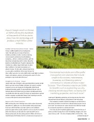
A quick Google search on Drones
 or SUAVs will result in hundreds
 of thousands of links to stories
 about how this technology will
  produce a multi-billion dollar

              industry.

Football Field Sized Surveillance Drones – France                                  “Commercial real estate users often prefer
A drone-satellite hybrid has been developed in                                       managed service solutions that include
France that will carry out a range of functions,
including surveillance, border security monitoring,                                    simple to fly missions, maintenance,
communications reinforcement and facilitating                                           insurance, and financing options,”
navigation— all from a stationary position—with the                                  commented AJ Jolivette of drone maker
help of two self-adjusting electric motors. About the                             Terosaur. “Then it becomes easy to use SUAVs
length of a football field and 25 yards in diameter, The                            for benefits such as augmenting security,
StratoBus has a blimp-shaped shell made of carbon                                 checking remote equipment, surveying and
fiber. It will float to the lower stratosphere at an                                 marketing properties, and much more.”
altitude of about 13 miles, with a mission length of up
to a year, with a total lifetime of five years. Because the                       estate space? Marketing, operations, and security are just a few of the
‘drone-tellite’ stays closer to earth, it will be able to take higher resolution  departments that have begun to show interest in the technology.
images and maintain a stronger communications system. The first
prototype is expected in about five years.5                                          One company in southern California has begun to use the drones to
                                                                                  take photos and videos of views from residential units that have not yet
Using Drones for Farming – Oregon                                                 been built. “I can show you the canyon view from the fifth floor” would
HoneyComb Corp. of Oregon is using agricultural drone systems to help             be an attractive statement to a prospective buyer.
farmers save time, money, fertilizer and water. The systems combine
mounted cameras and imaging technology with a tablet-based                           There have also been marketing applications centered on the use of
dashboard reporting system. As automated drones fly over acres of                 photos and video footage from inside the buildings. Imagine a five story
farmland, they record infrared and visual data to identify water levels,          atrium shot at a mall—the drone swooping down to the first floor—then
crop health and other data points. The drones are inexpensive to operate
and the company is working with Oregon State University to test the                                                                                continued on page 50
accuracy of the system’s measurement devices.6

Impacts on Real Estate Operations
While exciting, this new technology comes with a variety of potential
impediments. Liability due to accidents (public safety), privacy laws,
local, state and federal laws, execution expertise, noise pollution,
protection against drone attacks and other concerns must be reconciled
before this industry can truly take off, no pun intended! From an
industry perspective, the interesting question is: Where do Drones or
Small Unmanned Air Vehicles fit in the commercial and corporate real

                                                                                  Realcomm                                                                               23