


%20(1)%20(1)%20(1).png)
.png)
Developers Using LightBox GIS Software to Land Sites for New Products
Problem:
Identifying sites and acquiring land across 24 states is a lot of ground to cover. Toll Brothers needed the property data that could help them quickly qualify, or disqualify, potential land sites. Items like school district, where it is in the flood plain, are there water issues, are considerations that need to be accounted for when looking for land to acquire.
Solution:
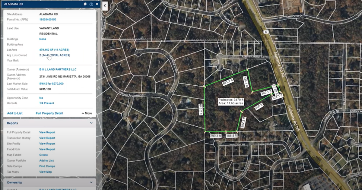
LightBox’s LandVision GIS mapping software offers lightweight geospatial capabilities, bringing together the critical layers needed for a clear view of site selection and land acquisition. Robust parcel information, property characteristics, ownership information, layered with flood plain, school boundaries, a view of the parcel over time, and points of interest give a thorough view of a potential building site.
Benefits of using a land mapping software:
- All of the tools needed for property search and investigation in a singled lightweight GIS tool
- View of the property and ownership to explore off-market opportunities
- Complete view of a property and its history over time
- Ability to export data for use in CRM or other workflow tools
- "LightBox is the only GIS platform that gives us the information we need when we need it."
-Regional Vice President, Land Acquisition, Toll Brothers
Toll Brothers is an award-winning Fortune 500 real estate company that has become the nation's leading builder of luxury homes. They currently build in 24 states nationwide, and they were named the World's Most Admired Homebuilder in Fortune magazine's 2023 survey of the World's Most Admired Companies®, the seventh year it has been so honored.
We spoke with their Regional Vice President for Land Acquisition about why Toll Brothers relies on LightBox and our LandVision™ product.
Why did you choose to use LightBox GIS mapping software at Toll Brothers?
In a previous position, I was what I'd call a "power user" of the LandVision platform. So, when I came to Toll Brothers, I didn't start using LightBox’s LandVision to solve a particular problem; I used it because I knew it worked. So, I dove in and started using it for site identification and land acquisition activities. All the functionality I had enjoyed before was there.
What do you most like about the LightBox platform?
What I really appreciate is the ability of our team to have a very robust one-stop GIS platform with multiple layers that can very quickly and easily weed out land that wasn't going to be right for development. Using LightBox, problems are easy to identify – such as if the parcel is in the flood plain or there is a water issue running through it, or it wasn't in the right school district it needed to be in. Or maybe the parcel abutting the land wasn't what we wanted – whatever we needed to know, it was easy to identify. That was definitely one key value proposition for us.
The next value proposition from LightBox was the property-site identification process –for example, the ability to overlay information like school districts. We could look at multiple land assemblages to see if someone owns a lot of land in one area — because, as a developer, you want it to be easy. You want to find the next big piece of land for a subdivision, like farmland that one family owned for the last 100 years – and they're no longer operating the land as a farm – and now the grandkids want to sell it. That's the classic situation.
But then what if it isn't one parcel? What if it's multiple parcels with one owner? What if it's various parcels with numerous owners with the same address? With LightBox, we could identify opportunities we usually couldn't see.
What exactly does LightBox LandVision provide for you?
LightBox's LandVision GIS product does a preliminary level of information-gathering and thinking for you with some of the search and functionality features offered to you that you don't have with any other GIS platform. Whatever you need, it's there.
All the pieces of land you see with LandVision are off-market pieces of land. It provides some starting points to get to ownership entities and ownership addresses. Right there, when you click on the parcel, you see the owner's name, their address, a link to the Board of Assessors to find the tax information. And there is also transaction history, which is excellent.
We eventually learned that through LandVision, you could choose any piece of land, anywhere – and you can find a starting point for the ownership history and a history of the parcel itself. You can see who owns the land around it, the length of ownership, and more. You can start to get a feel for what you're walking into. No other GIS platform has that capability. No other GIS can tell you the story of that parcel because no other GIS is designed to do that.
What about incorporating LightBox data into your workflow?
The most powerful piece was that LightBox allows us to export large groupings of parcels to Microsoft® Excel® so we can start working outside the program and feed the information into other company platforms like our CRM, where we can make mailing lists to send letters of inquiry. Once again, no other GIS platform has those capabilities, at least not that we're aware of. The outside integration after exporting data became incredibly powerful for us.
Almost forgot...Time View was another beneficial function. It lets us see what's happening on a piece of land, often before the plot is recorded. Maybe it's a mixed-use development we want to be a part of. Suddenly, the land around the development seems a lot more interesting. Time View was the first of its kind, and it's compelling. It's also beneficial in that it's historical. You can go back in time. It helps us see the story of an area.

|
Sherrie Clevenger, VP, Product Management, LightBox
Sherrie Clevenger has led high impact, customer-centric, data-driven initiatives throughout her career. She delivers meaningful results through data-driven strategy and impactful action plans. A results-focused manager and mentor, she builds collaborative cultures that empower teams to do their best work and motivate people to reach their full potential within their position. Sherrie holds the position of vice president, product management with LightBox. In this role, she manages a product portfolio ensuring that the customers biggest challenges are solved by ensuring the right strategy for each market serviced produces success. |
This Week’s Sponsor
LightBox is the world’s leading commercial real estate information and technology platform. Through operational excellence and a passion for innovation, LightBox facilitates transparency, efficiency, insight and prediction for real estate investment and location analytics. Our customers include commercial and government agencies requiring definitive real estate data and powerful workflow solutions, including brokers, developers, investors, lenders, insurers, technology providers, environmental consultants, and valuation professionals. LightBox is backed by Silver Lake and Battery Ventures.

Read Next
 5/15/2025
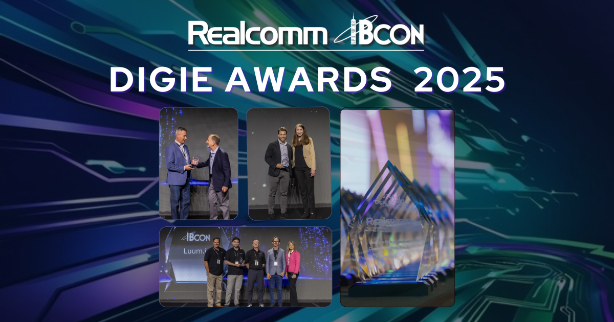
Tech, Talent and Transformation: 2025 Digie Finalists Announced For 27 years, Realcomm has presented the Digie Awards to acknowledge companies, real estate projects, technologies, and individuals that have advanced the commercial real estate industry through the strategic use of technology, automation, and innovation.
 5/15/2025
Empowering Space Management with Data-Driven Visualization For effective CRE space management, it’s critical to centralize lease data, maximize rental square footage (RSF), improve energy efficiency and reconfigure spaces to meet changing needs.
 5/8/2025
The AI-Powered Workplace Evolution: Redefining the Business Landscape In today's rapidly evolving business environment, the fusion of Artificial Intelligence (AI) and Workplace Management is revolutionizing the way organizations approach workspace optimization and operational efficiency.
 3/27/2025
The Convergence of Edge Computing, Cloud, and AI in Building Automation and Smart Buildings In the built environment, we have seen the convergence of Operational Technology (OT) and Information Technology (IT), later expanding to include Workplace Technologies (WP).